Road Map of the State of New Jersey
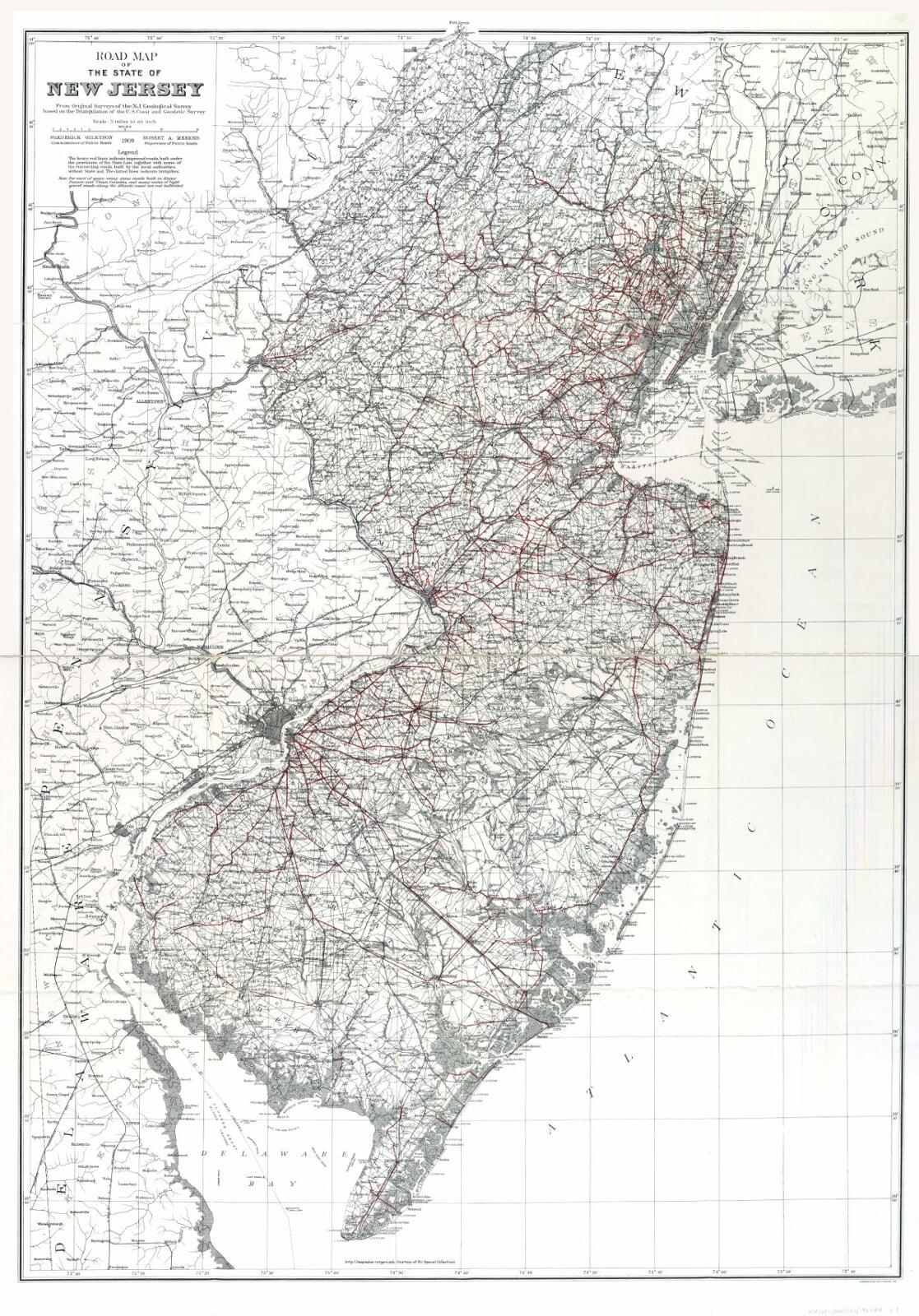
1909 Road Map of the State of New Jersey
From Original Surveys of the N.J. Geological Survey based on Triangulation of the US Coast and Geodetic Survey
Legend
The Heavy Red lines indicate improved roads, built under provisions of State Law; together with some of the connecting roads, built by the local authorities without State aid. The dotted Lines indicate turnpikes.